Districts and Local Authorities
At the Sri Lanka Red Cross Society, we recognize the importance of local governance in fostering community resilience. Through collaboration with local authorities and communities, we aim to empower and support the people of Sri Lanka, ensuring their well-being and safety in times of crisis.
Sri Lanka comprises 25 districts, each managed by a District Secretariat. These districts are further divided into 256 divisional secretariats and approximately 14,008 Grama Niladhari divisions. Districts, known as “Disa” in Sinhala and “Māwaddam” in Tamil, historically denoted duchies, with the administrative head titled the District Secretary.
Furthermore, Sri Lanka features three other types of local authorities: Municipal Councils, Urban Councils, and Pradeshiya Sabha (also known as Pradesha Sabhai). These entities originated from feudal counties, referred to as korale and rata, and were initially called “D.R.O. divisions,” evolving into “Assistant Government Agents” overseeing “A.G.A. divisions.” Today, these divisions are managed by a “Divisional Secretary.”
| Name | Area map | Province | District capital |
Land area | Inland water area |
Total area | Population | Population density |
|---|---|---|---|---|---|---|---|---|
| Ampara |  |
Eastern | Ampara | 4,222 km2(1,630 sq mi) | 193 km2(75 sq mi) | 4,415 km2(1,705 sq mi) | 592,997 | 140 /km2(363 /sq mi) |
| Anuradhapura | 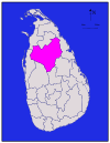 |
North Central | Anuradhapura | 6,664 km2(2,573 sq mi) | 515 km2(199 sq mi) | 7,179 km2(2,772 sq mi) | 745,693 | 112 /km2(290 /sq mi) |
| Badulla |  |
Uva | Badulla | 2,827 km2(1,092 sq mi) | 34 km2 (13 sq mi) | 2,861 km2(1,105 sq mi) | 779,983 | 276 /km2(715 /sq mi) |
| Batticaloa |  |
Eastern | Batticaloa | 2,610 km2(1,010 sq mi) | 244 km2(94 sq mi) | 2,854 km2(1,102 sq mi) | 486,447 * | 186 /km2(482 /sq mi) |
| Colombo |  |
Western | Colombo | 676 km2(261 sq mi) | 23 km2(8.9 sq mi) | 699 km2(270 sq mi) | 2,251,274 | 3,330 /km2(8,625 /sq mi) |
| Galle | 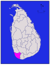 |
Southern | Galle | 1,617 km2(624 sq mi) | 35 km2 (14 sq mi) | 1,652 km2(638 sq mi) | 990,487 | 613 /km2(1,588 /sq mi) |
| Gampaha | 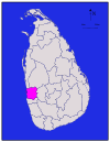 |
Western | Gampaha | 1,341 km2(518 sq mi) | 46 km2 (18 sq mi) | 1,387 km2(536 sq mi) | 2,063,684 | 1,539 /km2(3,986 /sq mi) |
| Hambantota |  |
Southern | Hambantota | 2,496 km2(964 sq mi) | 113 km2(44 sq mi) | 2,609 km2(1,007 sq mi) | 526,414 | 211 /km2(546 /sq mi) |
| Jaffna |  |
Northern | Jaffna | 929 km2(359 sq mi) | 96 km2 (37 sq mi) | 1,025 km2(396 sq mi) | 490,621 * | 528 /km2(1,368 /sq mi) |
| Kalutara | 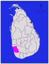 |
Western | Kalutara | 1,576 km2(608 sq mi) | 22 km2(8.5 sq mi) | 1,598 km2(617 sq mi) | 1,066,239 | 677 /km2(1,753 /sq mi) |
| Kandy | 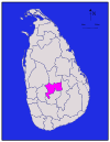 |
Central | Kandy | 1,917 km2(740 sq mi) | 23 km2(8.9 sq mi) | 1,940 km2(750 sq mi) | 1,279,028 | 667 /km2(1,728 /sq mi) |
| Kegalle | 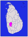 |
Sabaragamuwa | Kegalle | 1,685 km2(651 sq mi) | 8 km2 (3.1 sq mi) | 1,693 km2(654 sq mi) | 785,524 | 466 /km2(1,207 /sq mi) |
| Kilinochchi |  |
Northern | Kilinochchi | 1,205 km2(465 sq mi) | 74 km2 (29 sq mi) | 1,279 km2(494 sq mi) | 127,263 * | 106 /km2(275 /sq mi) |
| Kurunegala |  |
North Western | Kurunegala | 4,624 km2(1,785 sq mi) | 192 km2(74 sq mi) | 4,816 km2(1,859 sq mi) | 1,460,215 | 316 /km2(818 /sq mi) |
| Mannar | 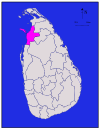 |
Northern | Mannar | 1,880 km2(730 sq mi) | 116 km2(45 sq mi) | 1,996 km2(771 sq mi) | 151,577 * | 81/km2 (208/sq mi) |
| Matale |  |
Central | Matale | 1,952 km2(754 sq mi) | 41 km2 (16 sq mi) | 1,993 km2(770 sq mi) | 441,328 | 226 /km2(585 /sq mi) |
| Matara |  |
Southern | Matara | 1,270 km2(490 sq mi) | 13 km2(5.0 sq mi) | 1,283 km2(495 sq mi) | 761,370 | 600 /km2(1,554 /sq mi) |
| Moneragala |  |
Uva | Moneragala | 5,508 km2(2,127 sq mi) | 131 km2(51 sq mi) | 5,639 km2(2,177 sq mi) | 397,375 | 72 /km2(186 /sq mi) |
| Mullaitivu |  |
Northern | Mullaitivu | 2,415 km2(932 sq mi) | 202 km2(78 sq mi) | 2,617 km2(1,010 sq mi) | 121,667 * | 50 /km2(129 /sq mi) |
| Nuwara Eliya | 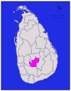 |
Central | Nuwara Eliya | 1,706 km2(659 sq mi) | 35 km2 (14 sq mi) | 1,741 km2(672 sq mi) | 703,610 | 412 /km2(1,067 /sq mi) |
| Polonnaruwa |  |
North Central | Polonnaruwa | 3,077 km2(1,188 sq mi) | 216 km2(83 sq mi) | 3,293 km2(1,271 sq mi) | 358,984 | 117 /km2(303 /sq mi) |
| Puttalam |  |
North Western | Puttalam | 2,882 km2(1,113 sq mi) | 190 km2(73 sq mi) | 3,072 km2(1,186 sq mi) | 709,677 | 246 /km2(637 /sq mi) |
| Ratnapura |  |
Sabaragamuwa | Ratnapura | 3,236 km2(1,249 sq mi) | 39 km2 (15 sq mi) | 3,275 km2(1,264 sq mi) | 1,015,807 | 314 /km2(813 /sq mi) |
| Trincomalee |  |
Eastern | Trincomalee | 2,529 km2(976 sq mi) | 198 km2(76 sq mi) | 2,727 km2(1,053 sq mi) | 340,158 * | 135/km2 (349/sq mi) |
| Vavuniya |  |
Northern | Vavuniya | 1,861 km2(719 sq mi) | 106 km2(41 sq mi) | 1,967 km2(759 sq mi) | 149,835 * | 81/km2 (208/sq mi) |
| Total | 62,705 km2(24,211 sq mi) | 2,905 km2(1,122 sq mi) | 65,610 km2(25,330 sq mi) | 18,797,257 | 300 /km2(777 /sq mi) |